

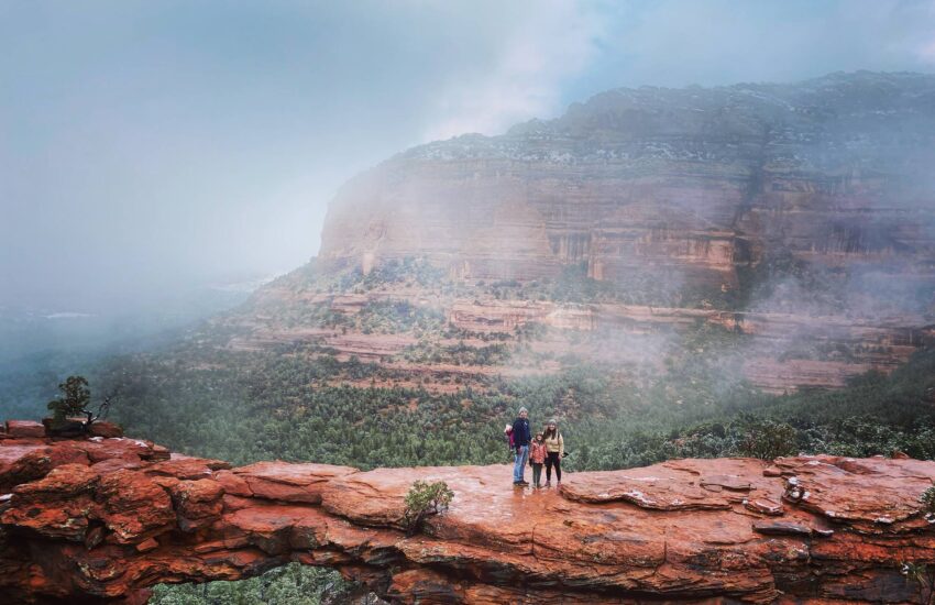
Devil's Bridge is the hike everyone wants on their Sedona list.
It is one of the area's most recognizable natural sandstone arches, and photographing it is a popular Sedona experience. The hike is manageable for many active visitors, but the last section is steep and exposed. The tricky part is often the logistics: where to park, which trailhead to use, and when to arrive.
Here is how to plan your Devil's Bridge hike the easy way.
Devil's Bridge at a Glance
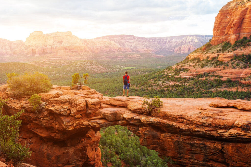
The U.S. Forest Service's 2024 Red Rock Recreation Guide lists the named Devil's Bridge trail at 0.8 mile one way (about 1.6 miles out and back), with approximately 350 feet of elevation change. That is only the final trail segment, not the full hike from paved parking or a shuttle stop.
The road toward the upper trailhead is rough and vehicle suitability depends on conditions. Most visitors should plan to begin from Mescal or Dry Creek Vista rather than assume they can drive to the upper trailhead.
| Starting point | Approx. round trip | Good to know |
|---|---|---|
| Upper Devil's Bridge Trailhead | 1.6 miles | Rough road access; do not assume standard-car access |
| Mescal Trailhead | About 4 miles | Scenic Mescal/Chuckwagon approach; Route 11 shuttle stop |
| Dry Creek Vista | About 4 miles by road; roughly 5.5–6 miles via Chuckwagon | Route 11 shuttle stop; choose the route before starting |
Distances vary with the exact route and trail junctions. Download a current map and count the round trip from your actual starting point.
Option 1: Start at Mescal Trailhead (Our Pick)
For many hikers, Mescal Trailhead is a practical approach to Devil's Bridge. It is reached from Long Canyon Road, off Dry Creek Road. Follow Mescal Trail and the connecting Chuckwagon route toward the Devil's Bridge trail junction, using posted signs and an offline map.
Why we like it: the approach adds desert scenery and avoids relying on vehicle access along the rough road. Parking is limited here too, so use the shuttle if available rather than assuming a space will be open.
Option 2: Start at Dry Creek Vista Trailhead
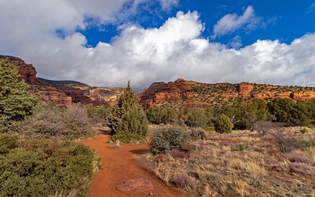
Dry Creek Vista is another popular starting point and can fill early on busy days. From here, hikers may use the rough access road toward the upper trailhead or take the longer Chuckwagon approach. The road can be dusty and shared with vehicles; the trail route is longer but avoids more road walking.
Do not park on undesignated shoulders or block access. If parking is restricted while shuttle service operates, follow the posted rules and use the designated park-and-ride.
Option 3: Skip Parking and Take the Sedona Shuttle
Sedona Shuttle Route 11 provides free trailhead transportation to both Dry Creek Vista and Mescal. Board at West SR 89A Park & Ride, 905 Upper Red Rock Loop Road. It is a convenient option for GreenTree guests driving from West Sedona.
The regular trailhead service runs Thursday through Sunday, generally from 7 a.m. to 5:30 p.m. Seasonal hours, specific last-return times, and any additional dates are subject to the published schedule. Do not assume extra winter-holiday service unless it appears on the official calendar.
Before leaving, check the Route 11 schedule and the current shuttle service alerts. Arrive early enough to finish your hike and catch your return bus.
Best Time to Hike Devil's Bridge
Time of day: Start early for cooler temperatures, softer light and potentially shorter photo queues. On busy days, the line for a bridge photo may take considerable time, so build in a buffer. If you go later, plan to finish well before dark.
Day of the week: Weekdays may be quieter, but conditions and crowds vary. Check whether a shuttle operates on your chosen day.
Season: Fall through spring often bring comfortable hiking conditions, but shaded rock can be icy in winter. In summer, start very early and avoid dangerous midday heat.
What the Hike Feels Like
The final Devil's Bridge Trail begins with a gradual ascent through juniper and pinyon. Near the arch, the route steepens into uneven natural rock steps. Some visitors use their hands for balance, and exposed sections demand careful footing.
The arch offers sweeping views across the red rock landscape. Walking onto it is optional. If heights make you nervous, stay on solid ground and enjoy the scenery from a safe viewpoint. Never crowd the edge or take risks for a photo.
Devil's Bridge Tips
- Wear hiking shoes with dependable grip; wet rock or ice can make the upper steps hazardous.
- Carry enough water for your full approach, especially in warm weather.
- Check posted parking-fee signs and the current Forest Service Red Rock Pass rules for your chosen lot.
- Bring a downloaded map, and follow designated trail connections instead of shortcuts.
- Be patient with photo lines; give everyone room to move safely.
- Keep dogs leashed and carry water for them. Consider whether the steep final steps are suitable for your dog.
- Pack out all trash and leave rocks, plants and the trail unchanged.
Frequently Asked Questions
How long does it take to hike Devil's Bridge? Allow approximately 2–3 hours from Mescal or Dry Creek Vista for many hiking parties, plus extra time for photos, breaks and crowds. Your route and pace may change the total.
Is Devil's Bridge hard? The named trail is commonly treated as moderate, but the final rock steps are steep. Longer approaches add mileage and time.
Is it safe to walk on Devil's Bridge? There is real exposure and fall risk. Walking onto the arch is optional; stay back from edges and avoid slippery or icy conditions.
Can I bring my dog? Leashed dogs are generally permitted on national forest trails, but the upper rocky section may not be suitable for every dog.
Make Devil's Bridge Part of a Bigger Red Rock Trip
Devil's Bridge is the headliner, but it is only the start. Pair it with a quieter outing at Fay Canyon or Doe Mountain, or choose another route based on your energy and the weather.
For more ideas, see GreenTree Inn Sedona's companion guide, Best Hikes in Sedona: 15 Trails for Every Skill Level (2027 Guide), when it is published.
GreenTree Inn Sedona makes a practical West Sedona basecamp for early trail starts. You're a short drive from Dry Creek Road and West SR 89A Park & Ride. After hiking, relax at the pool and hot tub and recharge for your next outing. Check your room category for available in-room features.
Pick your trail. Set your alarm. Plan your stay at GreenTree Inn Sedona or call (928) 282-9166.
