

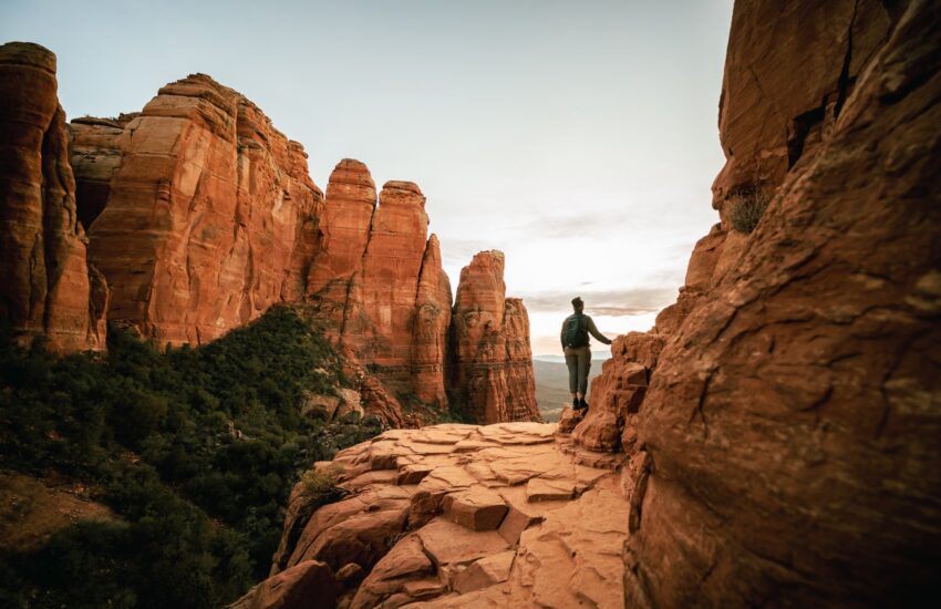
Sedona has hundreds of miles of trails. You only have a few mornings.
That is why choosing the right hike matters. Some trails are short and gentle. Others are short and steep. Some are famous for a reason, and some are quieter gems that visitors drive right past.
This 2027 guide breaks down 15 of the best hikes in Sedona by skill level, so you can match the trail to your group, your energy and your schedule. Whether this is your first trip or your fifth, there is a red rock trail here with your name on it.
How to Use This Guide
Distances are approximate and depend on the trailhead and route you choose. Check an official map before leaving, especially if you add side trips.
- Start early. Popular trailheads fill fast, and mornings bring cooler air and softer light.
- Check parking first. Many trailheads require a Red Rock Pass or an accepted federal recreation pass. Some are served by the free Sedona Shuttle.
- Look past the mileage. A two-mile Sedona hike can include rock steps, loose gravel and substantial climbing.
- Carry sufficient water for each person. Desert conditions can dry you out even in cool weather.
- Check current Forest Service closures and shuttle operating days before heading out.
New to Sedona trails? Start with A First-Timer's Guide to Sedona's Red Rock Trails and What to Pack for a Sedona Hiking Trip.
Easy Sedona Hikes
These choices offer big red rock views with manageable options. Easy does not mean paved: expect uneven surfaces, and check whether the route suits your group.
1. Bell Rock Pathway
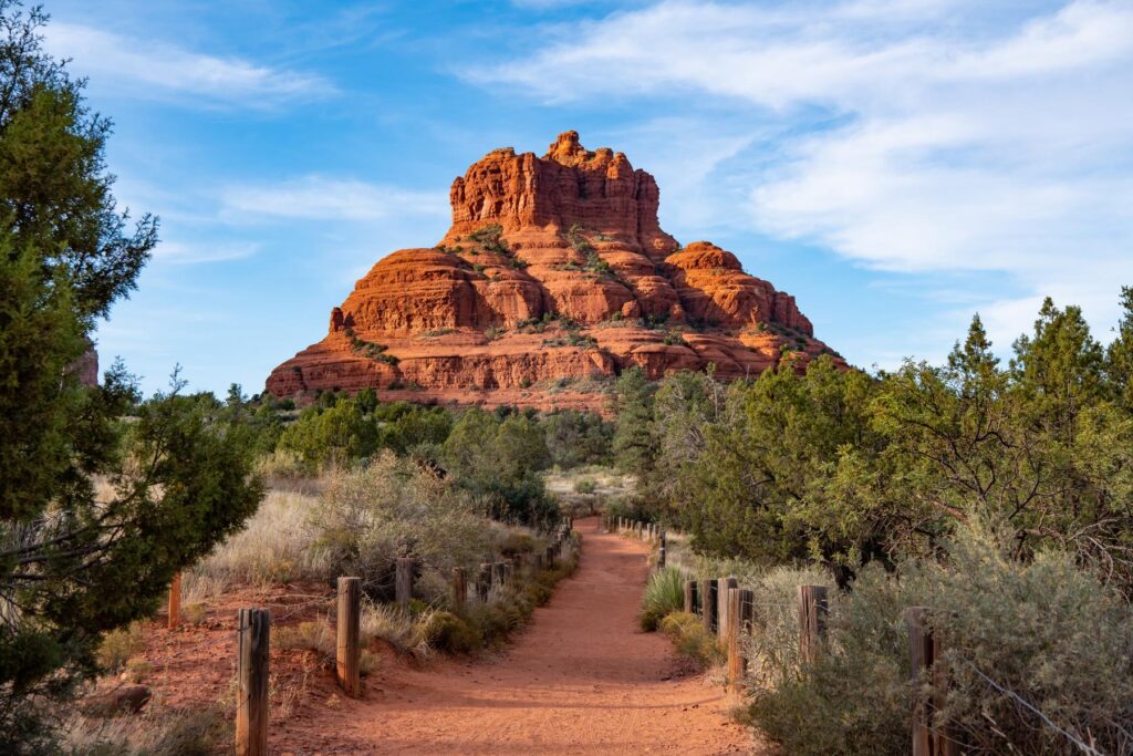
Well-marked and surrounded by red rock views, Bell Rock Pathway works particularly well as a choose-your-own-distance out-and-back. Climbing onto Bell Rock is a separate, steeper scramble.
Approximate route: Short out-and-back of your choosing; the full named pathway is about 3.7 miles one way | Best for: first-timers and flexible outings
2. Fay Canyon Trail
A mostly gentle canyon walk with towering red walls. The optional spur toward Fay Canyon Arch is rougher than the main trail, so do not treat it as part of the easy outing.
Approximate route: about 2.2 miles out and back on the main trail | Best for: easy canyon scenery
3. Baldwin Trail
A scenic route near Cathedral Rock and Oak Creek, with some rocky or uneven stretches. A longer loop requires connecting trails, so do not assume a single fixed distance.
Approximate route: about 2.5 miles for a common loop using connecting trails; verify your map | Best for: Cathedral Rock views
4. Courthouse Butte Loop
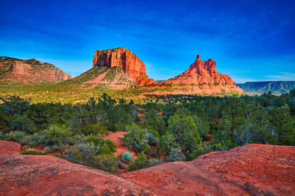
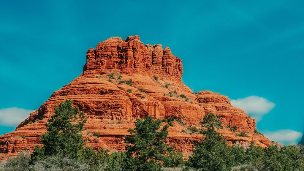
Walk around Courthouse Butte and Bell Rock as the formations change from every angle. It is a longer commitment than the short beginner walks and includes exposed sections.
Approximate route: about 4.3 miles from Bell Rock Vista on the Forest Service loop guide | Best for: a longer easy-to-moderate outing
Moderate Sedona Hikes
These hikes add more distance, elevation, or scrambling. Allow time for photo stops and consider your route back before you start.
5. Devil's Bridge Trail
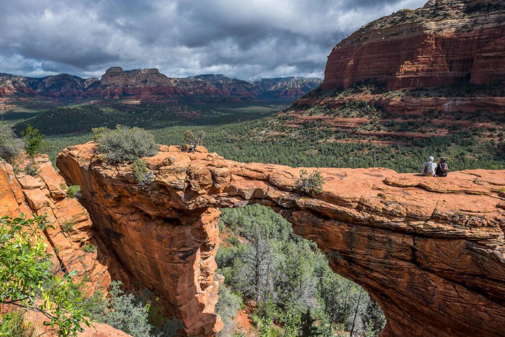
The sandstone arch is one of Sedona’s signature hiking destinations. The last portion climbs rocky steps and can become congested. Parking and shuttle access depend on your start point.
Approximate route: route dependent; roughly 4 miles round trip from the Mescal area with the appropriate connections | Best for: an iconic photo and rocky climb
Before visiting, check trailhead access and the current Sedona Shuttle routes before you go.
6. Soldier Pass Trail
Look for Devil’s Kitchen sinkhole and Seven Sacred Pools along this trail. The optional cave detour requires additional climbing and route-finding. The free Sedona Shuttle serves Soldier Pass Trailhead from Posse Grounds Park & Ride (20 Carruth Drive) on operating days.
Approximate route: roughly 4.8 miles out and back if walking the full named 2.4-mile trail; shorter landmark trips are possible | Best for: multiple landmarks and shuttle access
7. Boynton Canyon Trail
A longer red rock canyon hike with striking walls and a variety of scenery. The popular Subway Cave side trip is unofficial, steeper and not suitable for everyone.
Approximate route: about 5 miles out and back on the main Forest Service trail; longer with detours | Best for: a longer canyon day
8. Doe Mountain Trail
Switchbacks lead up to a broad mesa top with striking views. The climb is short but noticeably uphill, making this a moderate option rather than a flat beginner stroll.
Approximate route: about 1.4 miles out and back to the mesa top; extra distance if exploring the top | Best for: high views in limited time
9. Airport Mesa Loop
A close-to-town circuit with sweeping panoramas. Watch your footing on narrow, rocky sections and keep clear of exposed edges.
Approximate route: approximately 3.2 miles for the loop | Best for: panoramic views near town
10. Little Horse Trail
A steady hike toward Chicken Point with wide vistas and rock surfaces. The Sedona Shuttle serves Little Horse Trailhead from North SR 179 Park & Ride (1294 SR 179) on operating days.
Approximate route: about 3.5–4 miles out and back to Chicken Point, depending on start and connections | Best for: a steady climb to a big overlook
11. Broken Arrow Trail
Slickrock and sandstone formations make this a memorable outing. Jeep-tour routes are nearby, so stay aware of your surroundings and follow the signed hiking trail.
Approximate route: approximately 3 miles out and back on the named trail; longer with connections | Best for: red-rock formations and slickrock
Challenging Sedona Hikes
These hikes demand stronger fitness, careful route choices, and comfort with steep grades or exposure. Start early and check weather and trail alerts.
12. Cathedral Rock Trail
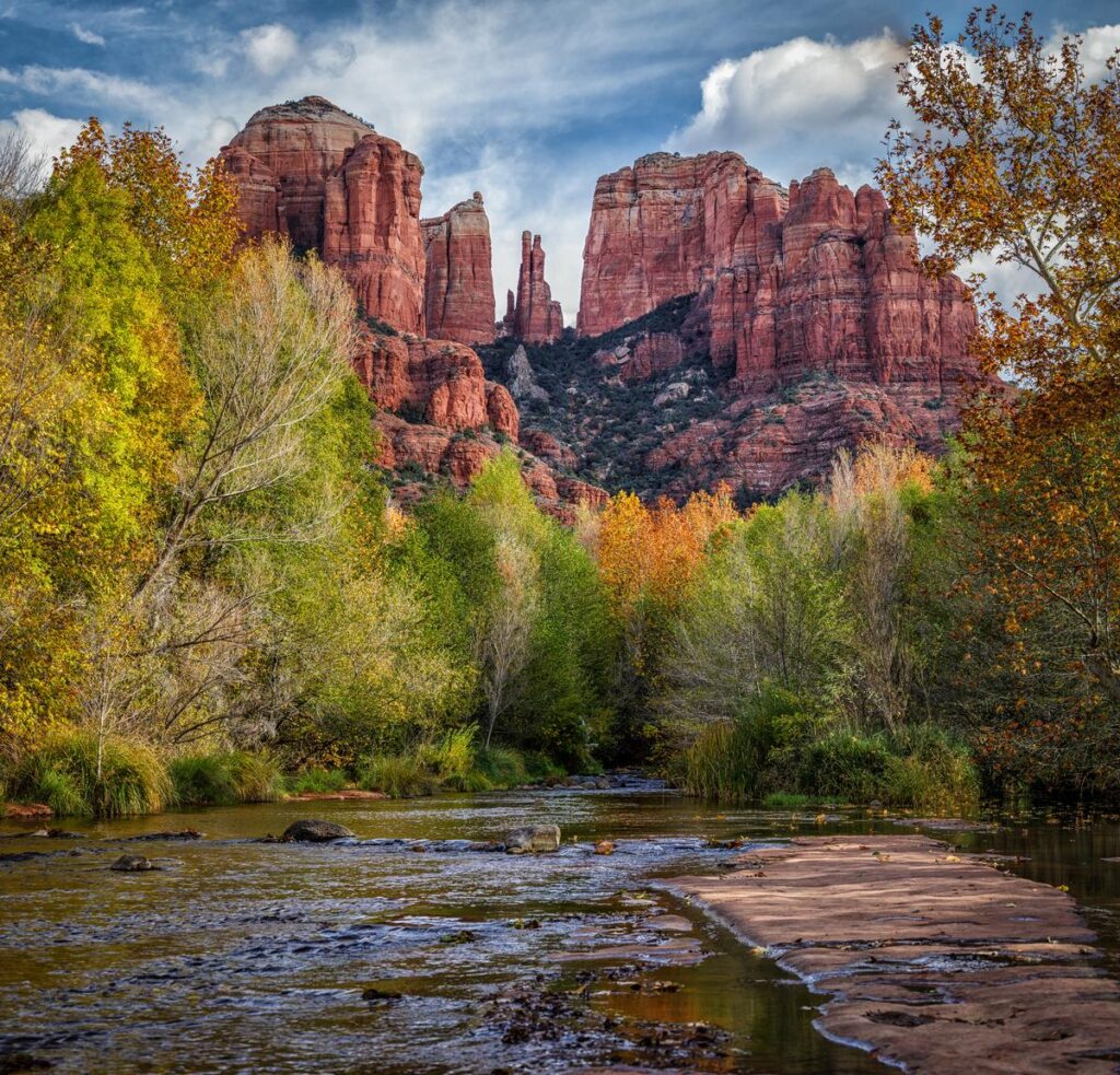
Short but steep, Cathedral Rock includes an exposed sandstone scramble to the saddle. Do not attempt it in slippery conditions or if heights make you uncomfortable. Shuttle service operates from North SR 179 Park & Ride when the route is running.
Approximate route: about 1.4 miles out and back | Best for: a steep, technical-feeling ascent
13. Bear Mountain Trail
Long climbing sections and false summits reward strong hikers with far-reaching scenery. Bring enough time and water for the return.
Approximate route: about 5 miles out and back with roughly 1,800 feet of climbing | Best for: strong hikers
14. Hangover Trail
Known for narrow, cliffside sections and substantial exposure. The named trail is part of a wider network, so the overall outing depends on the connections you take.
Approximate route: 3.3 miles for the named one-way trail; longer as a linked route | Best for: experienced, exposure-comfortable hikers
15. Wilson Mountain Trail
A demanding climb to a high plateau and broad overlooks. Route choice and trailhead affect mileage, and cooler weather can bring icy areas near the top.
Approximate route: a long full-day route, often around 10–12 miles round trip depending on approach | Best for: an ambitious summit day
Sedona Shuttle: Which of These Trails Does It Serve?
The official Sedona Shuttle lists both Soldier Pass and Little Horse as trailhead stops. Soldier Pass is served from Posse Grounds Park & Ride; Little Horse and Cathedral Rock are served from North SR 179 Park & Ride. Mescal and Dry Creek Vista are served from West SR 89A Park & Ride when those routes operate. It does not serve every trail on this list.
Review the current Sedona Shuttle routes, service days and parking restrictions before leaving. Normal trailhead service is generally Thursday through Sunday, with expanded dates at selected holidays; schedules can change.
When Is the Best Time to Hike in Sedona?
Spring and fall usually offer comfortable hiking weather, while winter can bring clear air and occasional snow or ice. Summer hiking requires more heat precautions; start early, shorten the route, and avoid extreme temperatures. At any time of year, check the weather, trail closures, and parking conditions on the morning of your trip.
Frequently Asked Questions
What is the most popular hike in Sedona?
Devil's Bridge and Cathedral Rock are especially well known, but there is no single official ranking of the most popular trail.
What is an easy hike with great views?
A short Bell Rock Pathway outing or Fay Canyon walk are accessible starting points for many visitors who are comfortable on uneven ground.
Do I need a pass to hike in Sedona?
Some Forest Service parking areas require a Red Rock Pass or accepted America the Beautiful pass. Check the sign for your particular parking site.
Are Sedona trails dog-friendly?
Dogs are allowed on many national forest trails when leashed. Check posted rules, carry water, and avoid hot surfaces.
Your West Sedona Basecamp for Red Rock Hiking
The best Sedona hiking trips are not about doing every trail. They are about choosing the right trails, at the right time, with a comfortable place to come back to.
GreenTree Inn Sedona puts you in West Sedona near the routes toward Fay Canyon, Doe Mountain, Boynton Canyon, Devil’s Bridge and Soldier Pass. After the trail, relax in the pool and hot tub, keep snacks in your room’s mini-fridge, and rest up for tomorrow. The hotel also lists free parking, complimentary Wi-Fi and pet-friendly accommodations.
Pick your trails. Set your alarm. Book your Sedona basecamp at GreenTree Inn or call (928) 282-9166.
